


SHREVEPORT — It’s still too early for any official forecast of the Red River’s crest at Shreveport, the National Weather Service said Sunday.
“The rise is going to occur during the last few days of June and early July,” meteorologist Patrick Omundson said Sunday.
He said there have been “some speculations and projections,” but nothing official.

Figures ranging from 34 feet to 30.5 feet have been discussed, The Times reported. Omundson said 34 feet was the high end of a range.
Jeff Graschel, a weather service hydrologist, told the newspaper that it’s possible the Red might reach major flood stage of 33 feet, but there’s still a lot of uncertainty.
Northwest Louisiana residents were told to “hold tight,” leave sandbags in place and stop extensive cleanup efforts until there’s certainty about crest projections.
“If you flooded before and had mud in your home, I would stop what I’m doing because more than likely you’re going to get water in your home again,” Bossier Parish Sheriff Julian Whittington said.
Bossier City Mayor Lo Walker recommended leaving sandbags in place, as did Shreveport officials.
The flood kept Jason Bragg from moving into his home. He was one week away from completing construction on the house in Les Maisons Sur La Rouge — in English, Houses on the Red — when he had to stop.
He said he would re-stack the sandbag wall around his home.
“We prepared for a certain level of rise. I understand prediction levels changed every day by feet, at some point, and that’s the thing that hurt us,” he said.
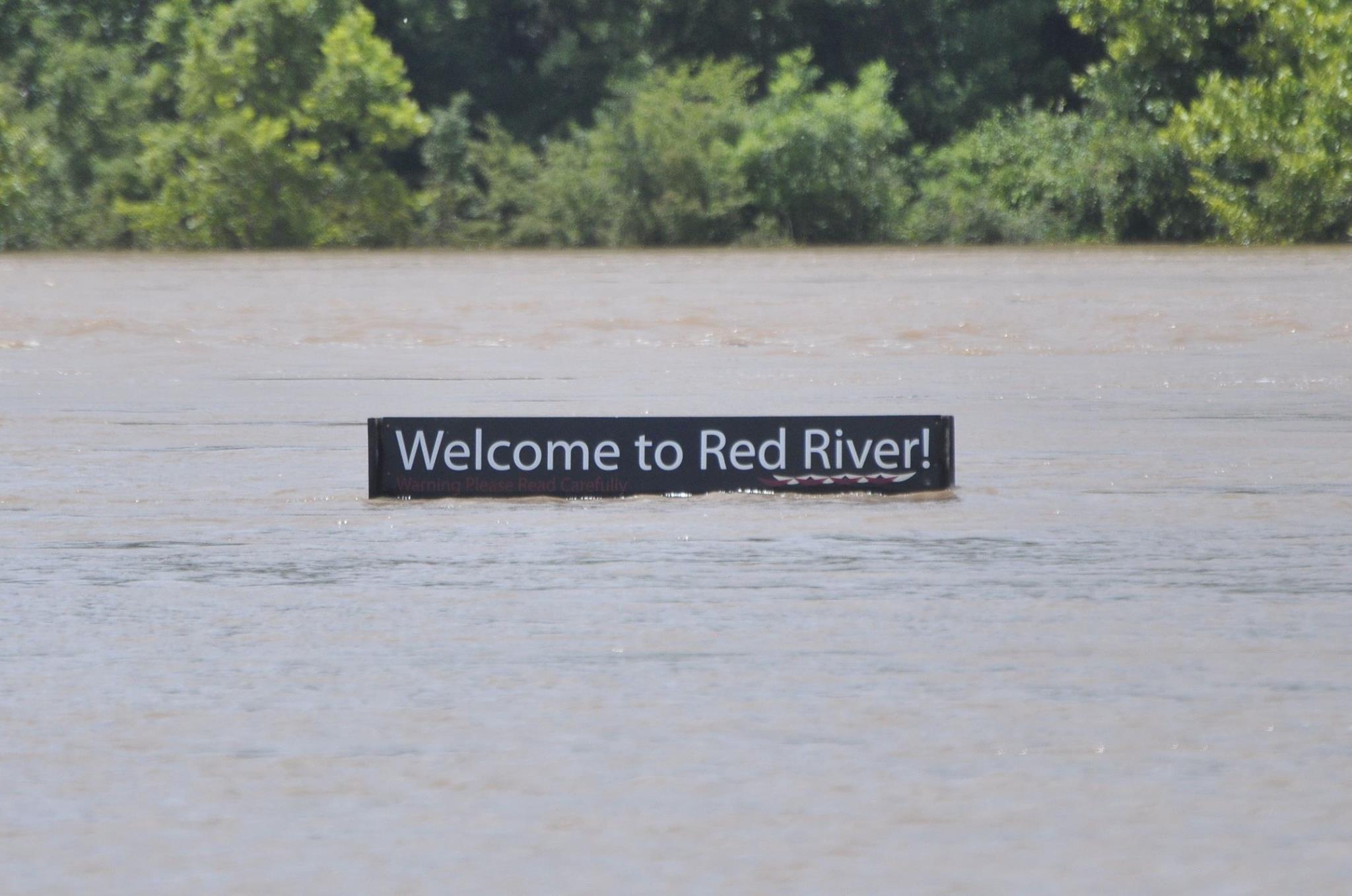
Weather service projections changed seven times in two weeks as the river rose earlier this month as floodwaters drained from Oklahoma and Texas. The river finally crested at 37.14 feet at Shreveport.
The weather service and corps of engineers used 1990 data as reference points even though up-to-date data was available. North Louisiana Congressmen want to know why.
U.S. senators Bill Cassidy and David Vitter and U.S. Reps. Ralph Abraham and John Fleming penned a strongly-worded letter, dated June 18, to high-ranking Washington officials in the Army, Army Corps of Engineers and National Oceanic and Atmospheric Administration.
“Communities throughout the state rely heavily on timely and accurate information from Army Corps and NWS on how threats from natural disasters will potentially impact life and property,” the letter said. “The constant change in crest predictions presented significant challenges for state and local first responders.”
The weather service bases river forecasts calibrated from historical data. They account for rainfall, both forecast and observed, soil conditions and other elements, hydrologists said.
Graschel said one problem with the weather service’s models was that stage levels around 34 to 37 feet hadn’t been seen since the 1940s.
“The channels changed since then,” Graschel said. He said the Corps’ discharge measurements had a different relationship between flow to stage.
“That’s when we had to start making adjustments and increase our forecast for the Shreveport area,” Graschel said. “Because of the channel changes and stuff, we were a little bit into unknown territories as to exactly what the peak flows would be at Shreveport.”
He said hydrologists now have a better understanding of the discharge levels up to 37 feet, though anything higher would remain problematic.
They’ve also learned Red River at Shreveport has less capacity to hold water flowing through it than it used to have, he said.